
Travel Information for Visiting Cotapata National Park
About Cotapata National Park
In Cotapata National Park (whose official name is Cotapata Integrated Management Natural Area) visitors can practice a wide variety of outdoor activities that take advantage of its extraordinary diversity of ecosystems and its cultural heritage. The main attraction is hiking, with trekking routes such as:
-
El Choro Trek Tuni Coroico, which exceeds 5,000 meters of elevation gain, crossing cloud forests, páramos, dry valleys, and high mountain zones.
-
Takesi, a route that crosses pre-Columbian paths to reach the picturesque town of Yanacachi in Sud Yungas.
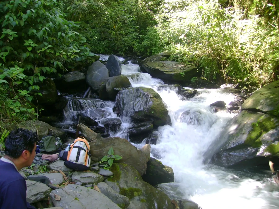
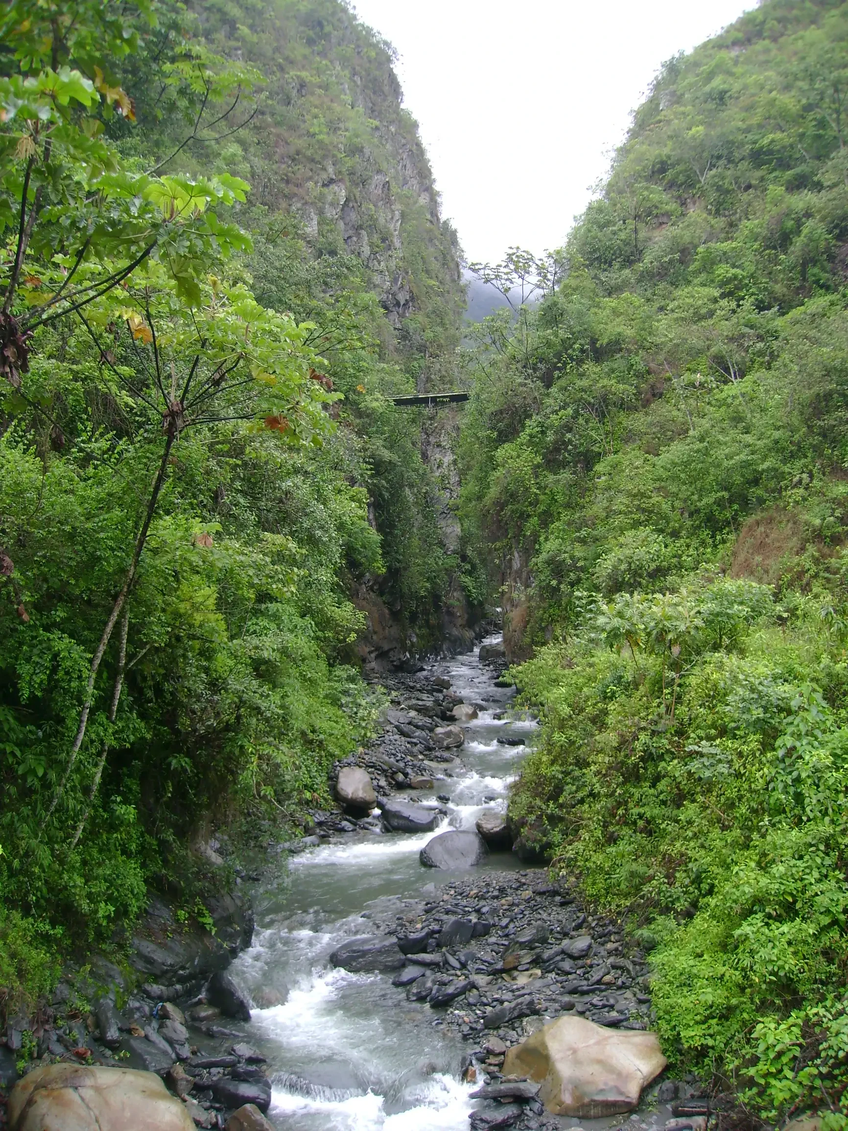
These routes allow you to observe waterfalls that unfold along the courses of the rivers that cross the park.
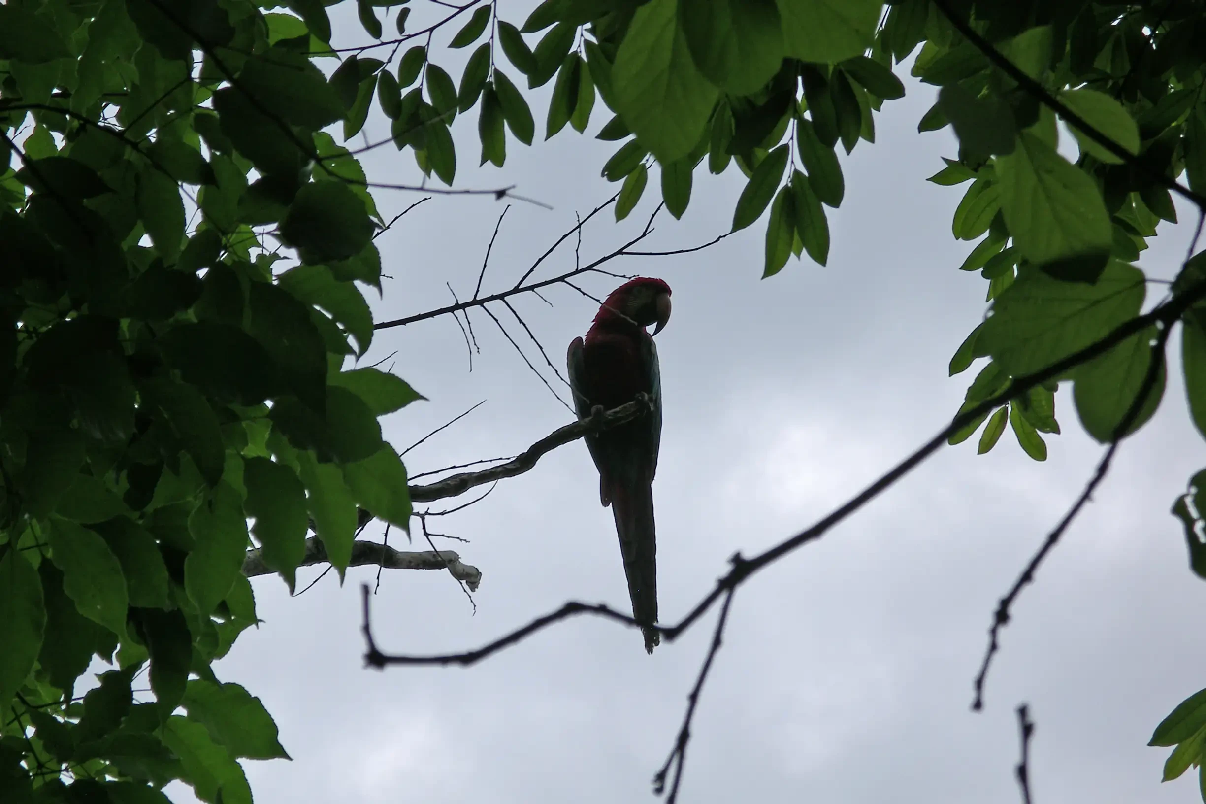
Another highlight is birdwatching: the area is home to more than 150 species, including the majestic Andean condor, macaws, kingfishers, and hummingbirds, making it a privileged destination for birdwatchers. Additionally, the trails follow pre-Columbian routes (the ancient Chucura/Inca road) that allow you to learn about the history of the Aymara peoples and their traditional settlements.
Visitors can complement the experience with guided tours that explain endemic flora such as: polylepis, orchids, and royal palms; and fauna such as: vicuña, puma, spectacled bear (Jucumari), and the sustainable practices of local communities, as well as participate in environmental education activities such as those carried out at the wildlife refuge: Senda Verde. Altogether, Cotapata offers a unique combination of trekking, wildlife observation, archaeological discovery, and cultural contact, just 20 km northeast of La Paz.
Tourist Attractions
Data
Management Category
National Park and Integrated Management Natural Area.
Extension
It has a surface area of 40,000 ha (400 km²).
Location
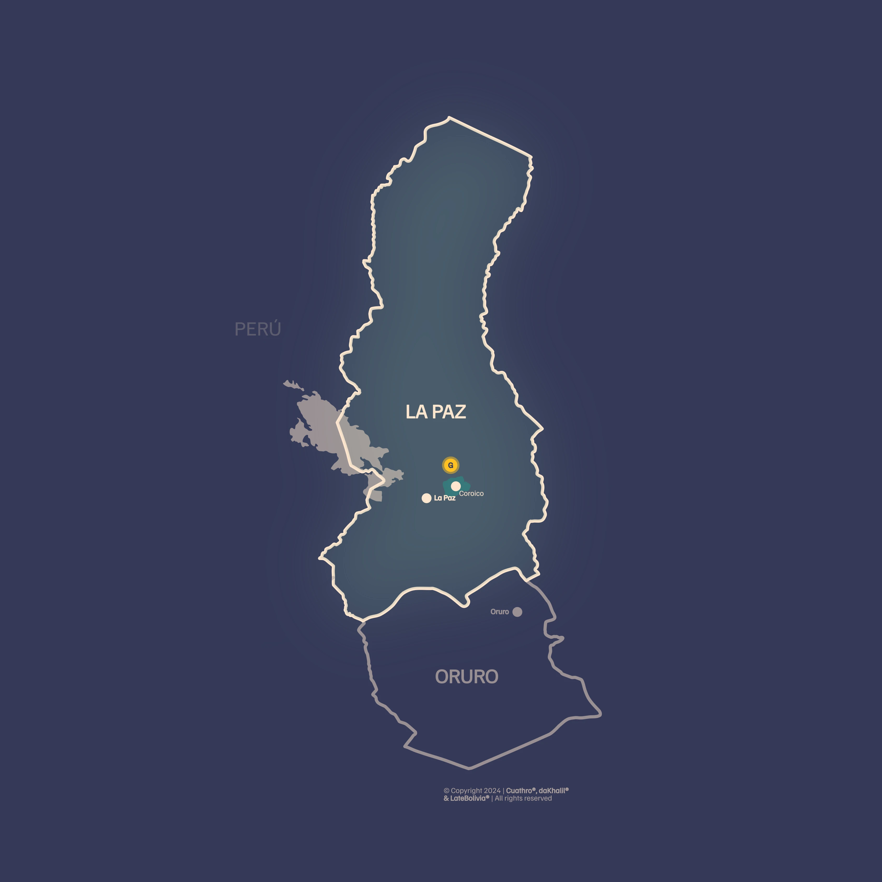
Cotapata Park is located northeast of the city of La Paz, next to the mountain wall. It begins on the road to the Yungas in the La Cumbre – Sacramento section, which corresponds to the southern limit. It is located in the Nor Yungas and Murillo Provinces of the La Paz Department. The municipalities involved are Coroico and La Paz.
Biogeographical Subregions, Altitudinal Range and Climate
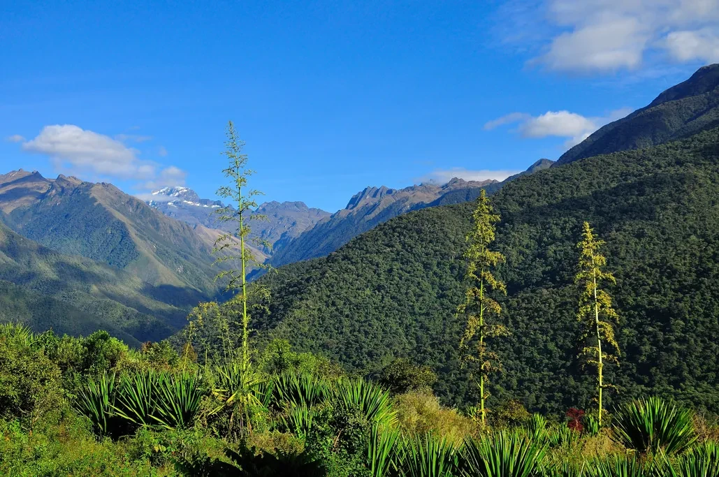
Puna and Yungas Humid Montane Forest; the altitudinal range varies between 1,000 and 5,900 m a.s.l.; physiographically it comprises parts of the Cordillera Real. The climate varies according to the altitudinal gradient from cold (freezing) in the heights to warm temperate towards the lower limit (near Coroico). Precipitation fluctuates between 1,000 mm in the upper part to more than 3,000 mm in the Cloud Forest of Ceja.
How to Get to Cotapata National Park from La Paz?
Access is possible by road or on foot using the pre-Hispanic Choro path (Inca Road). Daily buses are available from this city of La Paz (Villa Fátima area) that can be taken to Coroico or to La Cumbre for those who want to do the trekking route. From Coroico, it is possible to access the Huarinilla River valley by road; it is recommended to enter with your own vehicle as there is no public transport service to this sector.
Local Population
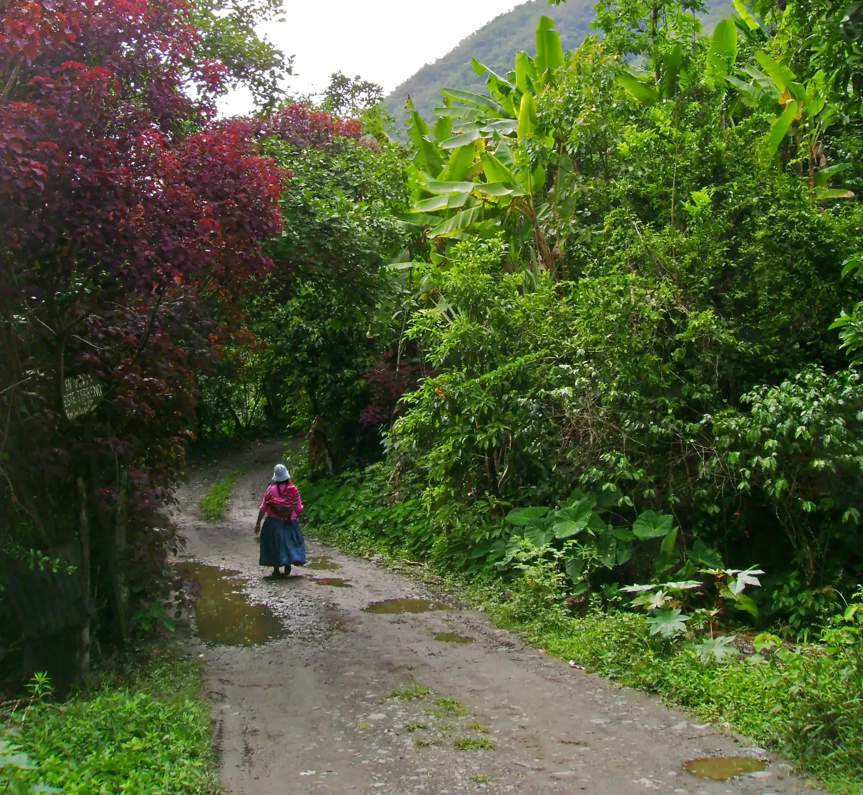
The population is of Aymara origin in the highlands and mestizo peasant and Aymara migrants in the Yungas valleys. Human occupation in the highland areas of Cotapata Park dates back many centuries, while the population settled in the Yungas is much more recent. The settlement pattern is central, as communities concentrate mostly along the Huarinilla River valley.
Among the most important are: Achura, Chucura, Choro, Tiquimani, Sandillani, Huancané, Chairo and Pacollo. Inside the Park, the total population is approximately 1,600 inhabitants (about 250 families). In the external buffer zone, the most populated urban center is Coroico (1,660 inhabitants); in total, a population of about 300 families is estimated (not counting Coroico). The PN ANMI Cotapata is located just 20 km from the city of La Paz.
Wildlife
204 fauna species have been recorded, some of which are in a threatened state, such as: the spectacled bear (Tremarctos ornatus), the Andean cock-of-the-rock (Rupicola peruviana), the mountain eagle (Oroaetus isidori), the oilbird (Steatornis caripensis), the black spider monkey (Ateles paniscus), the puma (Felis concolor), the titi or Andean cat or pampas cat (Felis jacobita), the taruca or Andean deer (Hippocamelus antisensis), the taitetu, peccary or collared peccary (Tayassu tajacu), the agouti with tail (Dinomys branickii), the red agouti (Dasyprocta punctata), the mountain guan (Penelope montagnii), and the little guan (Chamaepetes goudoutii).
Endemic bird species also stand out (Grallaria erythrotis, Schizoeaca harterti, Aglaeactis pamela, Myrmotherula grisea, and Hemitriccus spodiops), as well as the highly threatened species Anairetes alpinus, from the Tyrannidae family, and Cinclodes aricomae from the Furnariidae family.
Vegetation and Flora
820 plant species have been recorded, and the existence of approximately 1,800 higher plant species is estimated. The Area includes high mountain ranges and snowfields, periglacial environments, High Andean Grassland, peatlands and bogs, Yungueño Páramo, Ceja de Monte Rainy Cloud Forest, and Lower Montane Humid Forest of Yungas.
In the High Andean Grassland, hard and silicified grasses and rosette, creeping, and cushion plants predominate. In the peatlands of the wide glacial valleys, dense cushions of Distichia muscoides, Plantago tubulosa, and Oxychloe andina exist. Regarding the flora and vegetation of the humid forests, the relict woodlands of Polylepis pepei in the Páramo and the patches of Podocarpus spp. in the Ceja Cloud Forest stand out. Additionally, Cotapata National Park hosts many orchid species, including some endemic ones.
Tourism
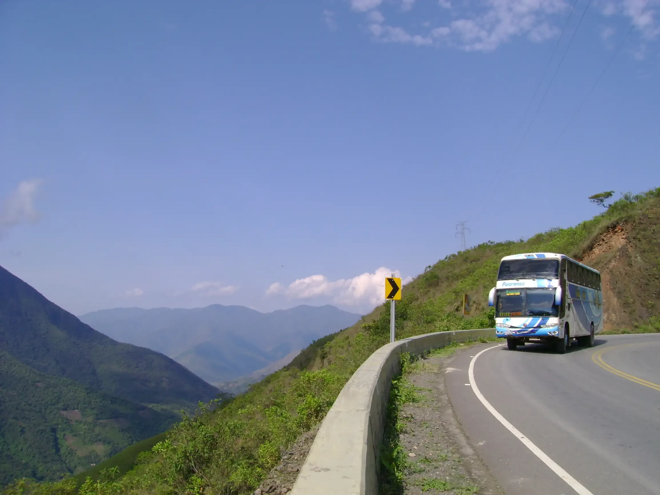
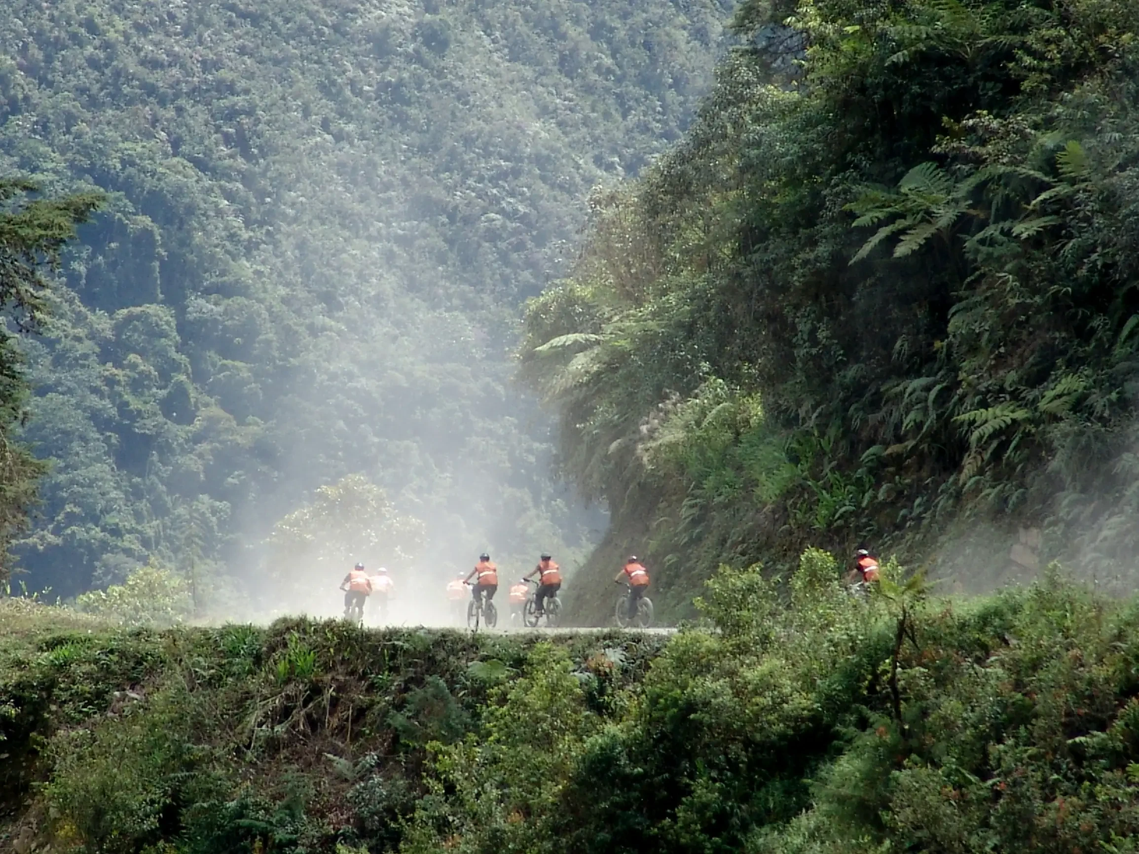
One of its greatest values is the pre-Columbian path of Chucura or Choro, which is part of the commonly known "Inca Roads"; Choro crosses Cotapata from the Cordillera region to the warm Yungas of the Huarinilla River. Currently, one of Bolivia's most visited tourist destinations is "The Death Road," also known as "The Most Dangerous Road in the World." It is a 65 km route from "Cumbre," a high mountain pass in the middle of the Andes Cordillera at 4,000 m a.s.l., until 15 years ago this route was the main access road to the Los Yungas forest.
This road became legendary due to its extreme danger, because of its steep slopes, very tight curves, with a road width of only one lane in many segments (3 meters wide). Currently, access to Los Yungas populations such as Yolosa and Coroico is through a new paved highway, so "The Death Road" is today an open route and almost exclusively consolidated as a tourist circuit for mountain bike descent.
This road gained even more notoriety in February 2012 when the international channel "History Channel" filmed the reality show "Dangerous Roads" on the road to Coroico. The series "Dangerous Roads" became famous due to the feats performed by a group of experienced truck drivers on dangerous routes in the Himalayas and Alaska.
Water Activities
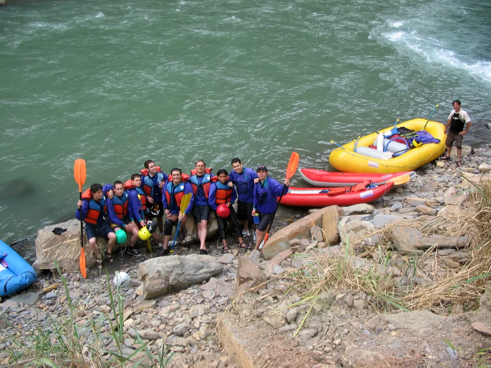
Within the Cotapata National Park and Integrated Management Natural Area, the hydrographic network is abundant: the rugged terrain and numerous streams flowing through the valleys create water currents wide and calm enough for practicing rowing sports. In the community of El Choro, a frequent access point for trekkers, local guides operate who organize canoe or rowboat trips along the river that feeds the wetlands and high-altitude lagoons, allowing visitors to observe riparian flora and aquatic fauna while enjoying a low environmental impact activity. These outings are usually combined with hikes to waterfall viewpoints and birdwatching, offering a comprehensive ecotourism experience that takes advantage of both water resources and the mountain landscapes of the park.
Tripadvisor
