
Cave expeditions, hikes and dinosaur footprints
About Torotoro National Park
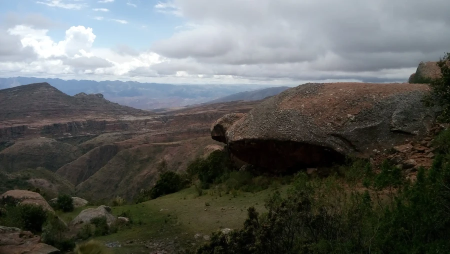
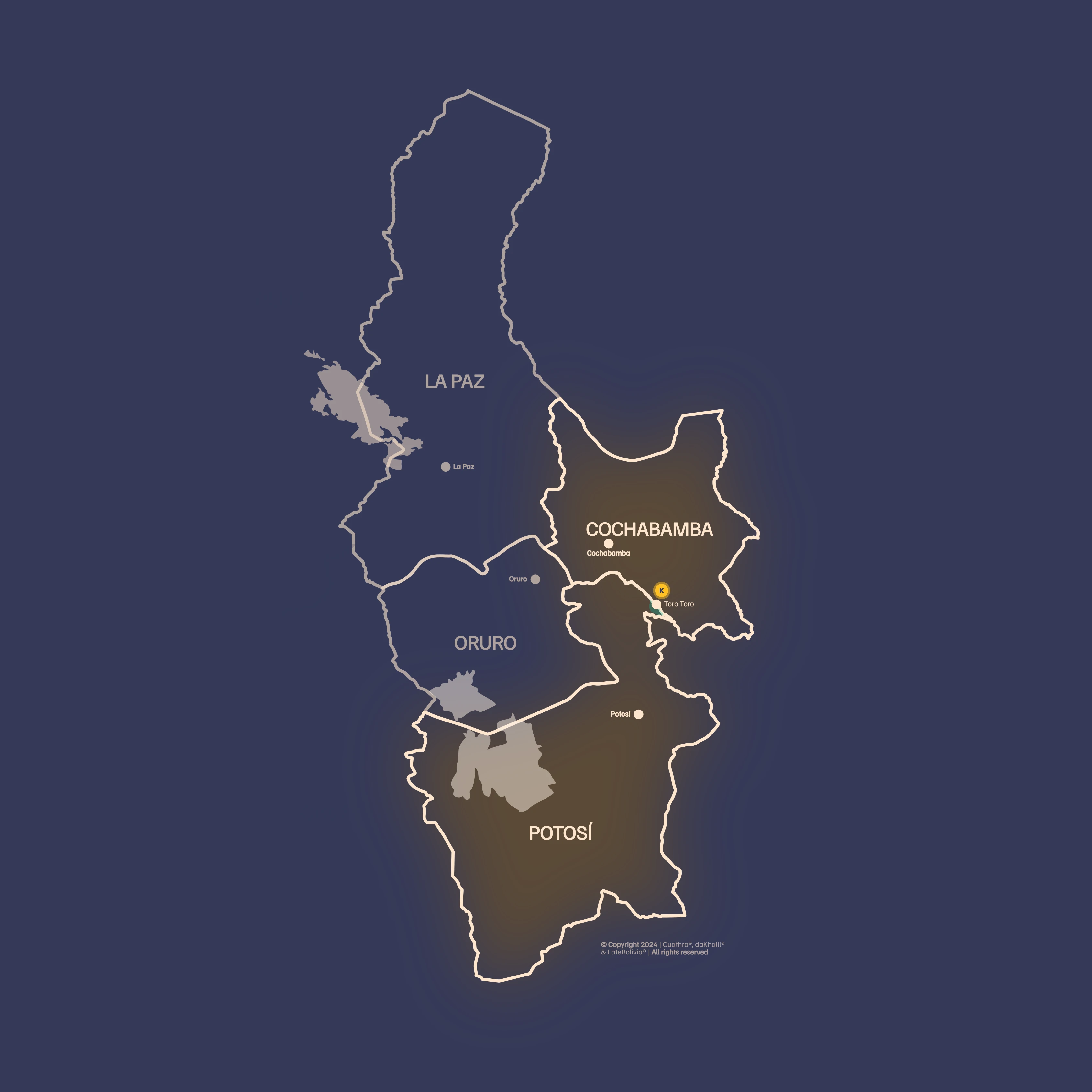
Torotoro National Park is characterized by its lush beauty—mountains, deep canyons, valleys, and waterfalls—but what truly captures attention is that it has become a paradise for paleontology lovers. It is located in the Charcas province in the northern part of the Potosí department, covering a protected area of ≈ 16 570 ha (165.7 km²) created in 1989 by Supreme Decree No 22269 to preserve its flora, fauna, paleontological and speleological resources. The relief consists of two mountain ranges that create inter‑Andean valleys, with elevations ranging from 1 800 m to 3 500 m, distributed across three altitude zones (low, intermediate, and high). Within its limits there are more than 60 caves, notably the Umajalanta cave, the largest and deepest, as well as deep canyons up to 300 m deep, rock formations known as the “Stone City” (Itas), and valuable dinosaur footprints that constitute one of the most important Jurassic collections in South America. The park also hosts 10 rural communities and the urban population of Torotoro, which participate in responsible tourism and conservation projects.
In recognition of its management, the Responsible Tourism Institute (ITR) awarded it the international “Biosphere” tourism certification in 2019, making it the first Bolivian destination to receive it, and in 2021 the UNESCO Global Geoparks Council visited the site with the aim of nominating it as a geopark, which would make it Bolivia’s first. To visit the park you must register at the National Protected Areas Service (SERNAP) office and purchase an entry ticket valid for four days; discounts are available for university students and organized groups. These features make Torotoro a benchmark for sustainable tourism, combining natural wealth, fossil heritage, and community participation.
Itinerary
Day 1
Cochabamba ➔ Umajalanta Cave
- Reception at Cochabamba Airport at 08:00 hours by private transport, to start our journey toward Torotoro, which is about 5 hours from the city of Cochabamba via the paved road up to the halfway point; the remainder of the route is dirt.
- Arrival in Torotoro for lunch.
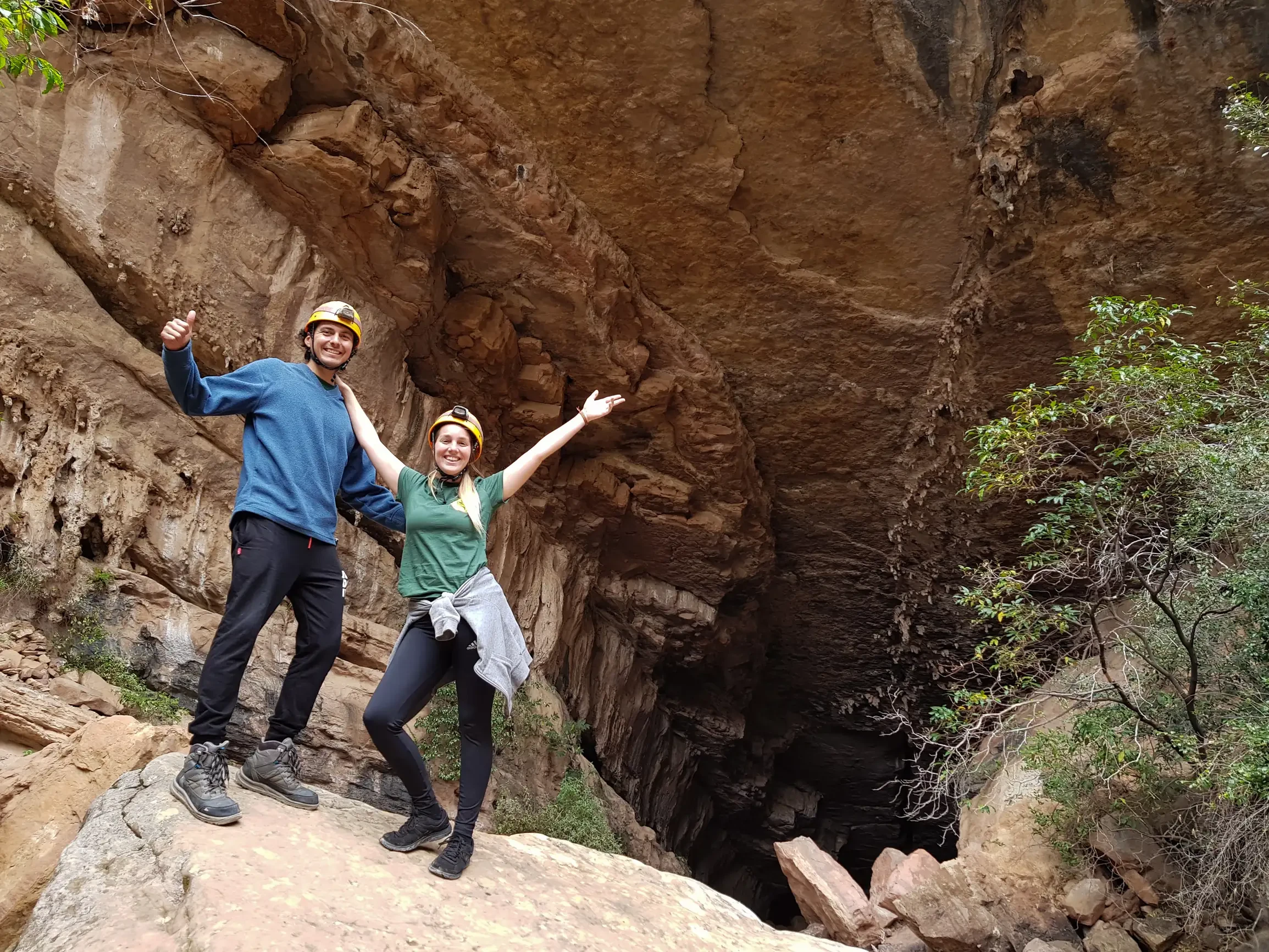
- In the afternoon we will register at the Torotoro National Park office and prepare to depart for the Umajalanta Cave, where stalactites, stalagmites and blind fish can be observed.
Day 2
Torotoro Canyon ➔ “El Vergel” Waterfalls
- After breakfast, we start the visit walking to Wayllas Hill, where hundreds of footprints of various dinosaur species can be seen.
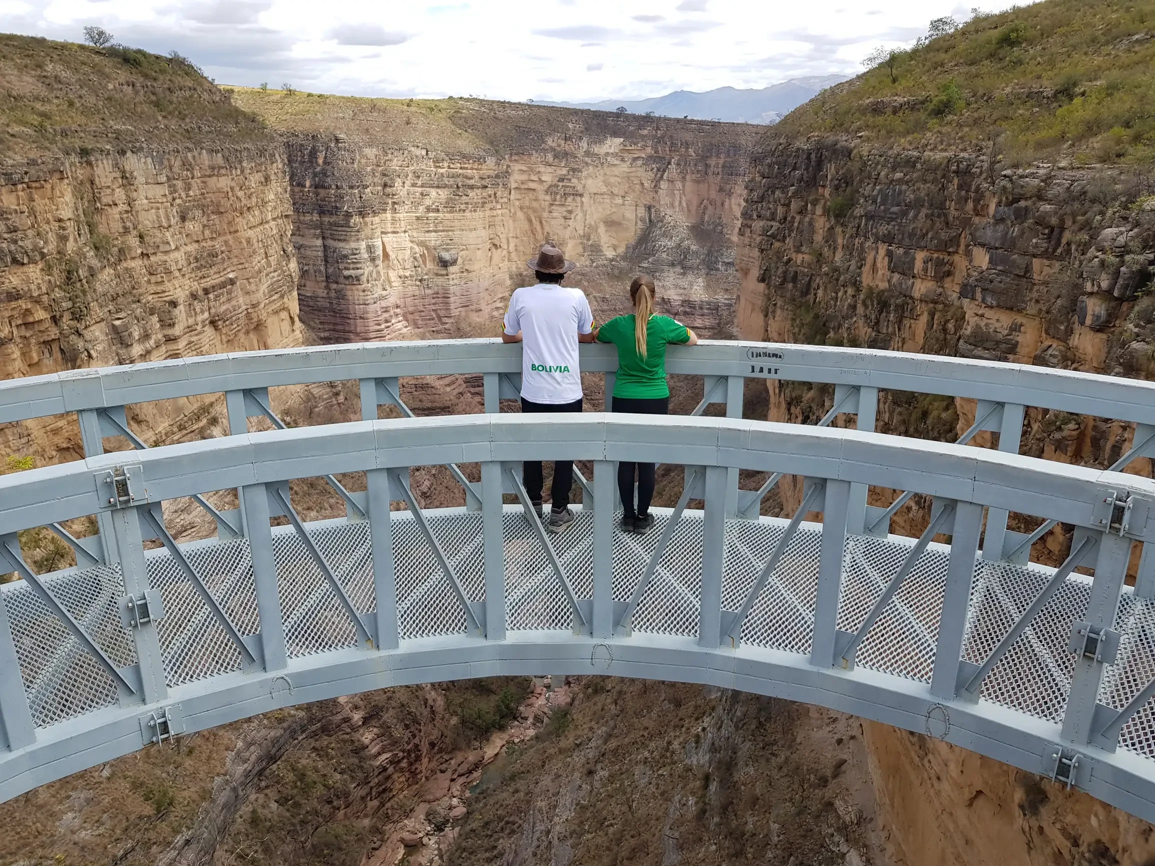
- We’ll do a ~7 km walk along the rim of Torotoro Canyon, observing dinosaur footprints and very attractive rock formations.
- A short stop at the Hanging Viewpoint, from where the red‑fronted parrots can be seen at a distance.
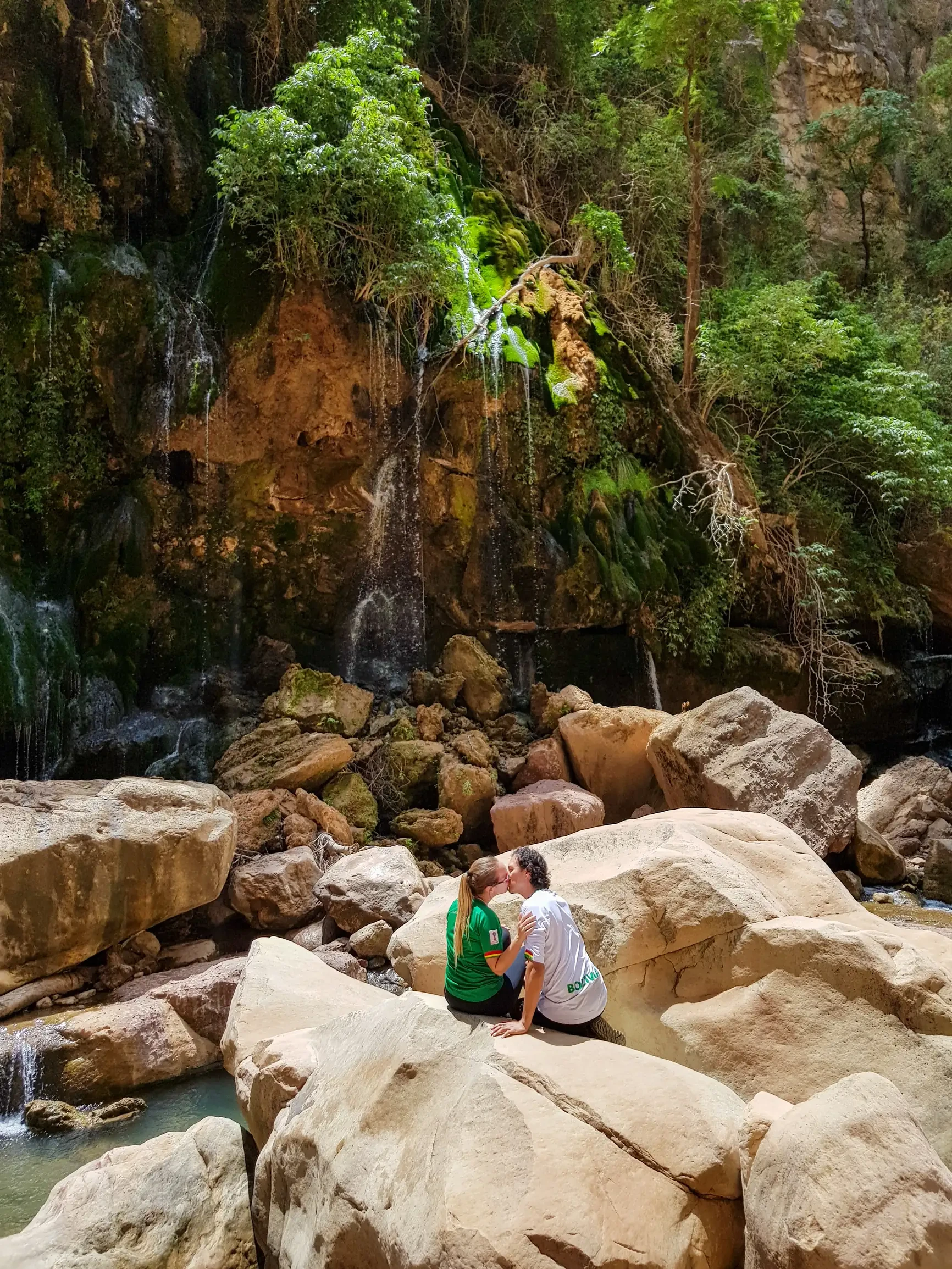
- We rest while enjoying a tasty snack appreciating the El Vergel waterfalls; here we can enjoy a refreshing swim in crystal‑clear water.
“El Vergel” Waterfalls ➔ Torotoro
- Return walk to Torotoro.
- Visit to the Lithic Museum Pachamama Wasi where a vast collection of fossils and various lithic formations can be seen.
- Visit to the craft centre where you can acquire beautiful and original handicrafts.
- Departure by private transport to the town of Torotoro and expedition to the Umajalanta Cave.
- Night in Torotoro.
Day 3
➔ City of Itas
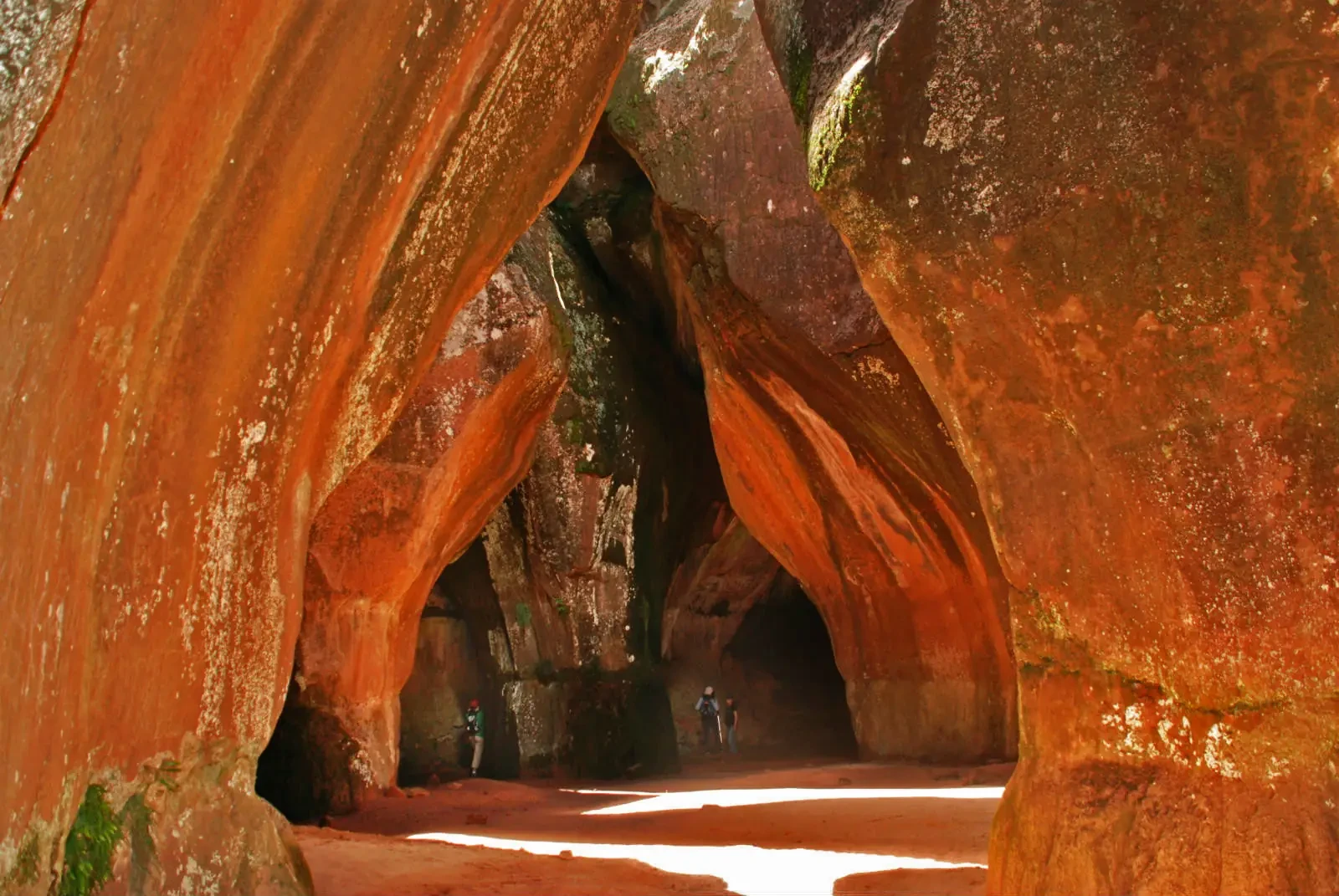
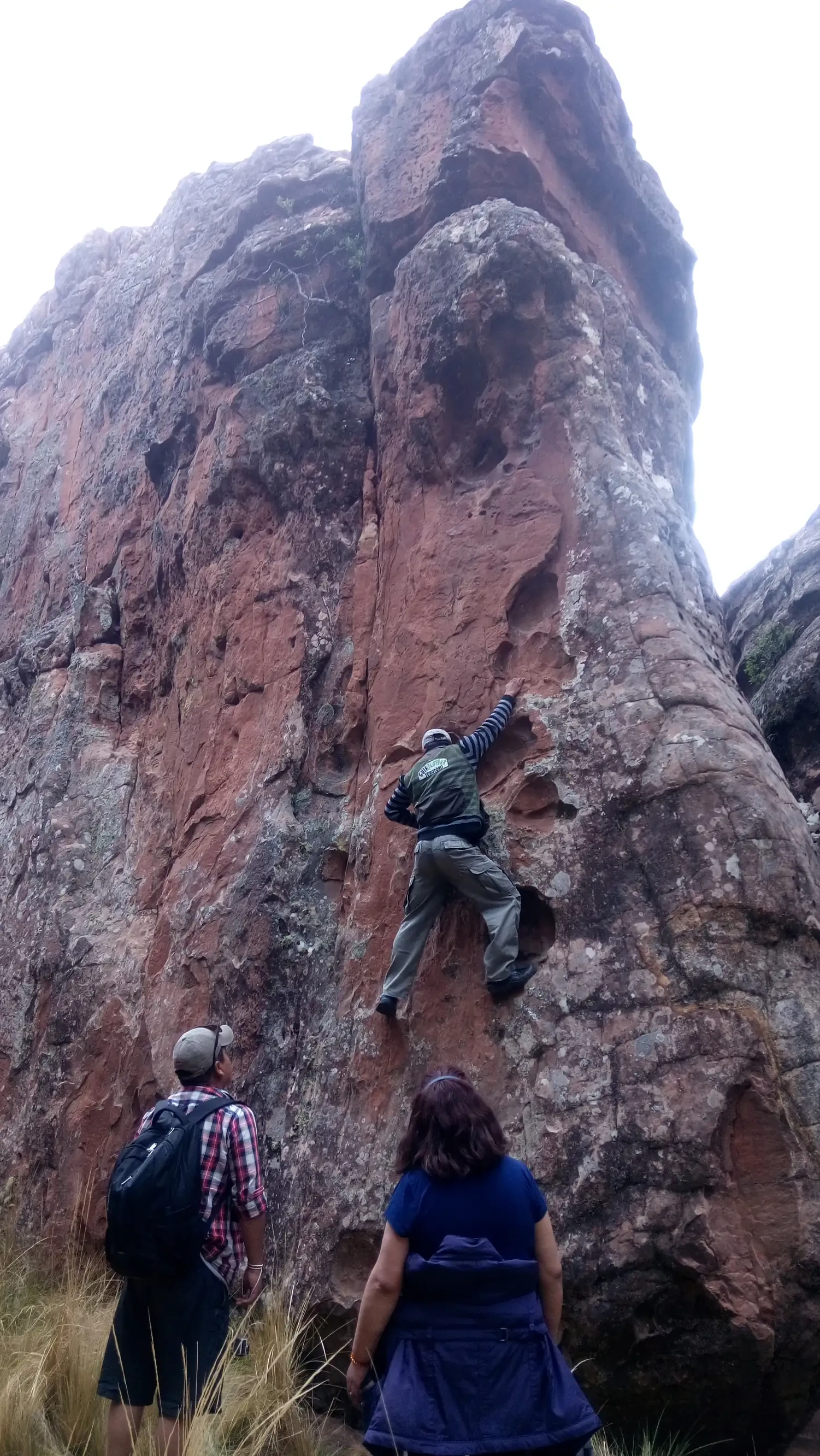
- After breakfast, we set off toward the City of Itas, where a series of rock formations can be observed; we are almost 4,000 m a.s.l. This “City” features labyrinths and stone galleries that form a kind of Gothic city, nestled in a range of sedimentary rocks. There, the caves are connected by narrow passages, stone bridges, and some rock paintings can be found.
- Departure after breakfast for dinosaur‑track observation, a hike through Torotoro Canyon, and a dip in the Vergel Waterfalls.
- In the afternoon we will visit Chiflon Qaqa and Mushroom Valley.
Important notes
Availability:
✓ Tours are available every day of the week.
➔ Access to the various tourist attractions may be limited during the rainy season (which runs from December to March), and the roads that lead to the town of Torotoro may also be affected.
Requirements:
✓ To pass some road checkpoints, you may be asked to present identification, such as your passport.
Important data:
✓ Torotoro National Park is situated between 1,800 m a.s.l. and 3,500 m a.s.l.
Health information:
✓ Make sure you are in good health and have enough stamina to participate without difficulty.
Includes
Not Included
Tripadvisor

Request a quote
Tours at Torotoro National Park
5 days and 4 nights