
Are you in Bolivia? Find the best tourist destinations
About Bolivia
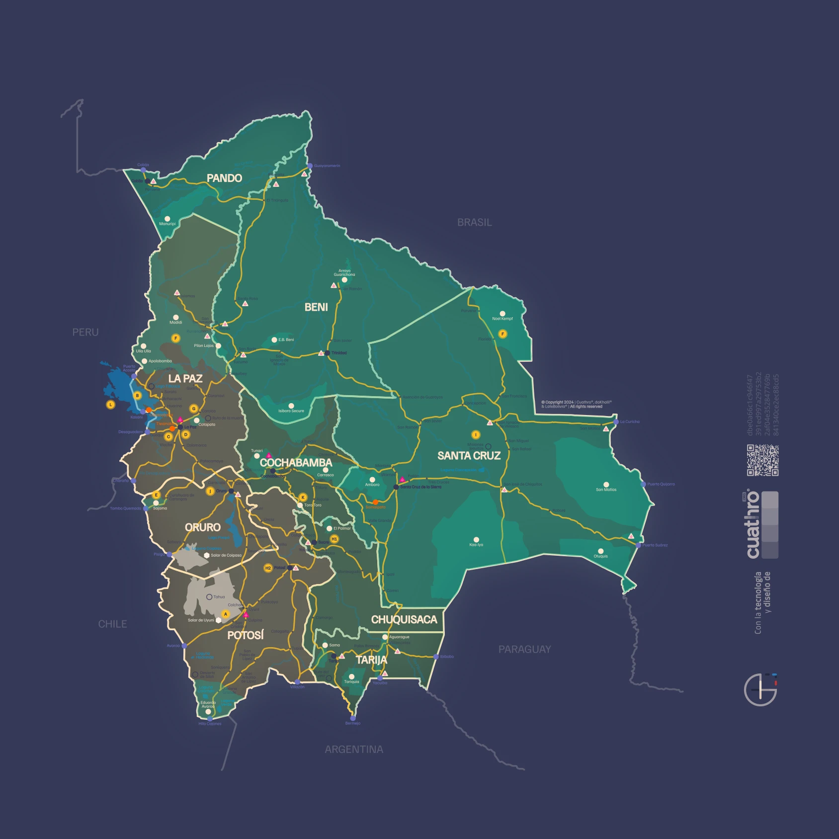
Bolivia is a diverse tourist destination that combines the Andean Altiplano, temperate valleys, and Amazonian lowlands in a single country. In the Altiplano, La Paz stands out as the gateway to attractions like Lake Titicaca and Tiwanaku; Oruro, famous for its carnival; and Potosí, a historic mining city near the Salar de Uyuni. In Uyuni lies the world's largest salt desert, an icon of tourism in Bolivia.
In the inter-Andean valleys, Cochabamba stands out, recognized for its gastronomy and pleasant climate; Sucre, the constitutional capital and colonial gem; and Tarija, the heart of the wine and singani route. These regions offer green landscapes, historical heritage, and unique cultural experiences.
Towards the eastern lowlands extends the Amazon and the Bolivian Chaco. Santa Cruz de la Sierra is the main economic center and starting point for national parks and Jesuit missions. Trinidad, in Beni, allows exploration of pampas and Amazonian jungle, while Cobija, in Pando, connects with lush tropical forests.
Traveling through Bolivia means traversing unique geographical contrasts: from snow-capped mountains to biodiverse jungles, passing through colonial cities and ancestral communities. An ideal country for cultural, adventure, and nature tourism in South America.
Are you in Bolivia? Here are the best tourist destinations
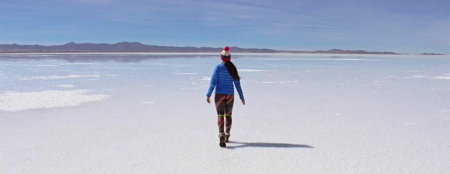
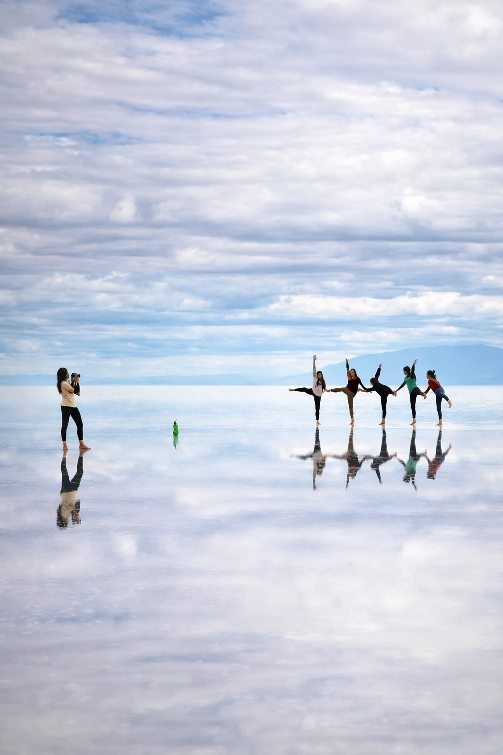
Salar de Uyuni and the Eduardo Avaroa Reserve
THE WORLD'S LARGEST MIRROR
Uyuni is a municipality whose history recounts the grandeur of the railway era in Bolivia, when its Central Station became a connection axis with Southern countries after the War of the Pacific, which left Bolivia without sovereign access to the sea. It is the gateway to the Salar that bears its name, which for indigenous people is called Thunupa, an immense white sea that constitutes an inexhaustible resource center for Bolivia.
Uyuni is also the entry portal to the Eduardo Abaroa Andean Wildlife National Reserve (REA), where the colored lagoons are located: Laguna Verde and Laguna Colorada, two sites whose landscapes recall the paintings of Catalan painter Salvador Dalí.
The Salar de Uyuni and the Sud Lípez region compose the most visited tourist region in Bolivia, due to its extraordinary landscapes, unique in the world.
Reservoir of the world's largest salt and lithium, the Salar de Uyuni is an immense expanse of rugged beauty and infinite horizons. A true "inner sea," with traces of marine fossils, calcareous formations, and giant cacti, where one experiences the most overwhelming solitude and silence. Immaculately white in the dry season and a perfect mirror of the sky in the rainy season, the Salar reserves mirages for its visitors that can confuse the senses, turning its journey into an extraordinary experience.
The Eduardo Abaroa Reserve in Sud Lípez treasures natural and geological riches of incomparable beauty. There, strange rock formations, pools with hot springs, fumaroles, and the famous colored lagoons, such as Colorada and Verde, the latter at the foot of the imposing Licancabur volcano, are combined.
In the region, there are rustic hotels and lodges located in wonderful natural environments in what was the Lordship of the Lipez, between the Salar de Uyuni and the border with Chile (Hito Cajón). The natural landscapes, colored lagoons, fumaroles, hot springs, and typical fauna of the region make up a unique tourist route.
Location: Department of Potosí, provinces D. Campos, A. Quijarro, Nor Lípez, and Sud Lípez
Nearest capital city: Potosí, 215 km
Altitude: From 3,653 to 4,895 m asl
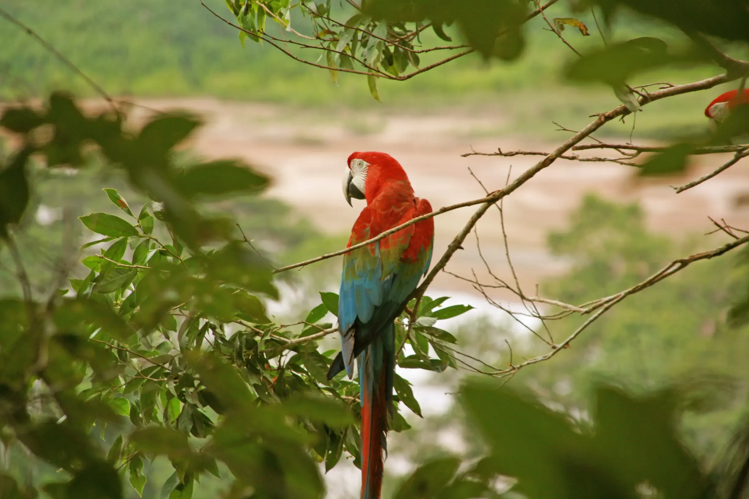
Amazonia
NATURAL AND CULTURAL WEALTH
Occupying almost two-thirds of our territory, the Bolivian Amazon basin is a vast repository of natural biodiversity, with flora and fauna in a virgin state, in protected areas like Madidi National Park and the Manuripi-Heat Amazonian Wildlife National Reserve in the department of Pando. Crossed by gigantic and extraordinary rivers like the Beni, Madre de Dios, and Mamoré, it is a set of forests, lagoons, and savannas with cities like Rurrenabaque, Trinidad, Riberalta, Guayaramerín, and Cobija, built based on the economic importance of rubber, Brazil nuts, and trade.
The Bolivian Amazon holds important archaeological riches, especially from the Mojeño culture like Chuchini, near Trinidad, whose gigantic mounds and hydraulic constructions continue to generate questions among scholars. Many of the original cultures of this region continue to maintain ancestral traditions and ways of life, in harmonious relationship with nature.
The Bolivian Amazon has a relevant historical heritage, with missionary towns like San Ignacio de Moxos and localities like Loma Suárez or Cachuela Esperanza, whose republican cultural and architectural heritage portrays the economic splendor of northwestern Bolivia, in the midst of the rubber boom at the end of the nineteenth century. As well as the Tacana culture of northern La Paz.
Northern La Paz
Location: Department of La Paz, provinces Abel Iturralde and Franz Tamayo
Altitude: 1,025 m asl
Temperature: 21 °C, annual average
Trinidad
Location: Department of Beni, Cercado Province
Altitude: 155 m asl
Temperature: 26.1 °C, annual average
Cobija
Location: Department of Pando, Nicolás Suárez Province
Altitude: 235 m asl
Temperature: 28 °C, annual average
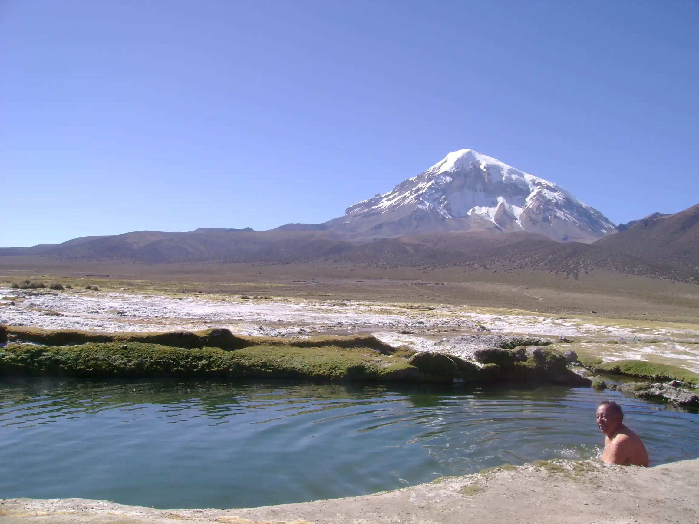
Sajama National Park
THE CONTRAST OF NATURE
If there is a place where the history of planet Earth is taught by nature itself, it is Sajama National Park, located in the northwest of the Oruro department, 255 kilometers from the city of La Paz.
In this park, one can find hot springs, bofedales with their eternal moisture, trees that grow decade by decade (queñua), mosses that are more combustible than petroleum itself (yareta), kollpares, geysers, volcanoes, eternal snows, and the wisdom of a people who have lived there for centuries. Among all that magnificence stands the Nevado Sajama, the father of the entire zone, the "doctor," as traditional healers call him, the tutelary entity of the park, patron saint of Bolivia. His companions of millennia, Pomerape and Parinacota, are his two guardians.
Location: In the extreme southwest of Bolivia, on the border with Chile, comprising the area of the Nevado Sajama volcano and the valleys of the Sajama river basin
Nearest capital city: Oruro, 70 km
Altitude: 3,800 m and 4,200 m asl
Temperature: Cold alpine climate; the average annual temperature is ≈ 5 °C (maximums of 12-15 °C in the valleys and minimums below 0 °C in the highest areas, with frequent frosts and snow for most of the year).
La Paz
MARVEL CITY
Situated in a fertile valley, in the middle of the high plateau, La Paz is a unique city, like the contrasts of its particular geography. Political, cultural, and artistic capital of Bolivia, on its steep and narrow streets combine the multiple traits of our indigenous, colonial, republican, and contemporary identity. An intense city, with multiple options for cultural tourism, commerce, entertainment, and fun.
Location: Department of La Paz, Murillo Province
Altitude: 3,650 m asl
Temperature: 11.2 °C, annual average
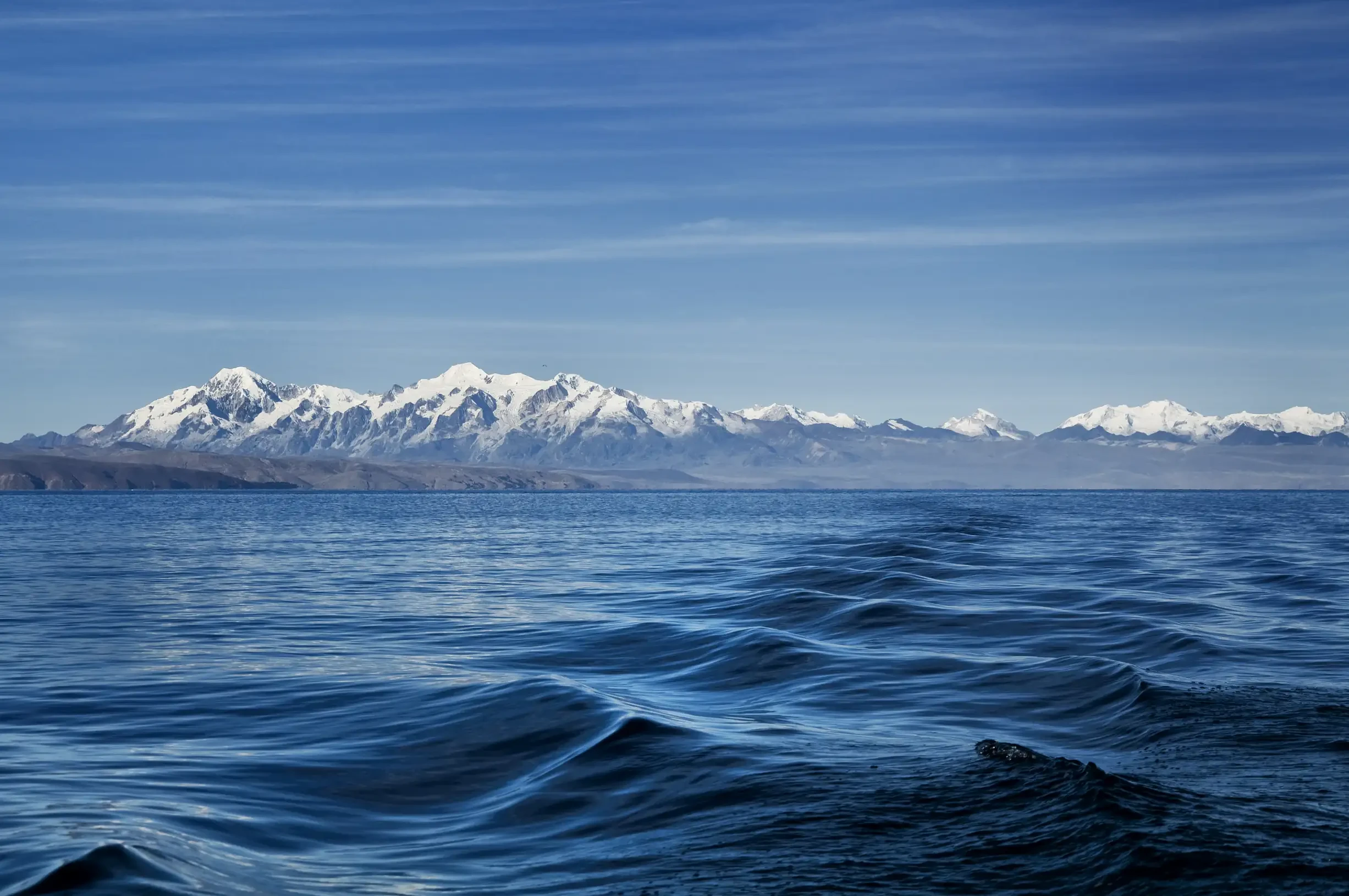
Titicaca
THE SACRED LAKE
Surrounded by beautiful snow-capped mountains, Lake Titicaca is the highest navigable surface in the world and home to ancestral Aymara agricultural and fishing communities. It is an essential source of Bolivian culture and a meeting point for religions, traditions, and beliefs. Besides its landscapes full of energy and mysticism, Titicaca has several attractions of interest due to their archaeological and cultural relevance.
The Copacabana peninsula, a ceremonial center since pre-Hispanic cultures, which houses the sanctuary of the Virgin of Candelaria, one of the most important pilgrimage sites in our country. Suruki, an island of renowned totora raft builders. The island of Pariti with a museum of Tiwanacota ceramics, recently discovered. The beautiful islands of the Sun and the Moon, where Inca monuments of great significance are preserved, such as the Pilcocaina Palace, the Chinkana, the sacred sanctuary of Titi Kala or Rock of the Puma, and the Iñak Uyu Palace or Temple of the Moon.
Sampaya
Sampaya is a community on the shores of Lake Titicaca, in the municipality of Copacabana, where a thematic circuit has been organized that values the millenary urban and architectural structure, its cultural attractions, and the beauty of its natural surroundings. It offers accommodation services and typical crafts, in addition to views of cultivation terraces, drainage and irrigation systems, all of Inca origin.
Location: Department of La Paz, Manco Kapac Province
Nearest capital city: La Paz, 147 km
Altitude: 3,841 m asl
Temperature: 11.5 °C, annual average
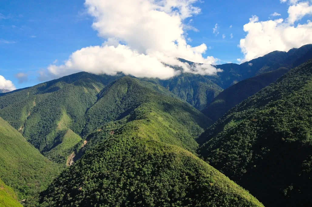
Los Yungas
FERTILE LAND
The Yungas of La Paz are a mountainous eco-region populated by dense forests with endemic flora and fauna coexisting in harmony with Mother Earth. It is a region located in the department of La Paz, whose rivers, roads, forests, and mountains have become a preferred destination for Adventure Tourism.
In La Paz, the Los Yungas zone is divided into two provinces: Nor Yungas and Sud Yungas; the first has Coroico, Coripata, Tocaña, and Yolosa as its main urban centers, while in Sud Yungas are Chulumani and Yanacachi, as beautiful tourist destinations.
In Los Yungas, activities such as mountain biking along the so-called Death Road are carried out, a dangerous path whose edge is surrounded by a ravine of kilometers in height. On the other hand, sports like paragliding, long-distance cycling, mountaineering, and hiking are practiced by tourists who come from distant countries due to the interest in knowing a zone that still maintains its biodiversity and ecology.
In this zone lives the Tocaña ethnic group, of the Afro-Bolivian community, direct descendants of the first men of color brought by the Spanish from Africa for work in the mines of the colony.
The town of Yolosa is considered the entry gate to Coroico. In its surroundings is the Cedro Mayo Lagoon, a natural swimming spot that offers a place of rest for tourists and visitors. In addition to allowing them to enjoy attractions like the Senda Verde Wildlife Recovery Center. Yolosa is an important center to learn more about high-altitude coffee production and coca leaf crops.
Location: Covers the municipalities of Coroico, La Paz, Yungas, and surroundings
Nearest capital city: La Paz, 60 km
Altitude: 1,000 – 2,300 m asl
Temperature: Subtropical mountain climate; the annual average is around 22 °C (oscillating between 18 °C in the highest valleys and 26 °C in the lowest sectors), with a marked rainy season from November to March and a short dry season from May to October.
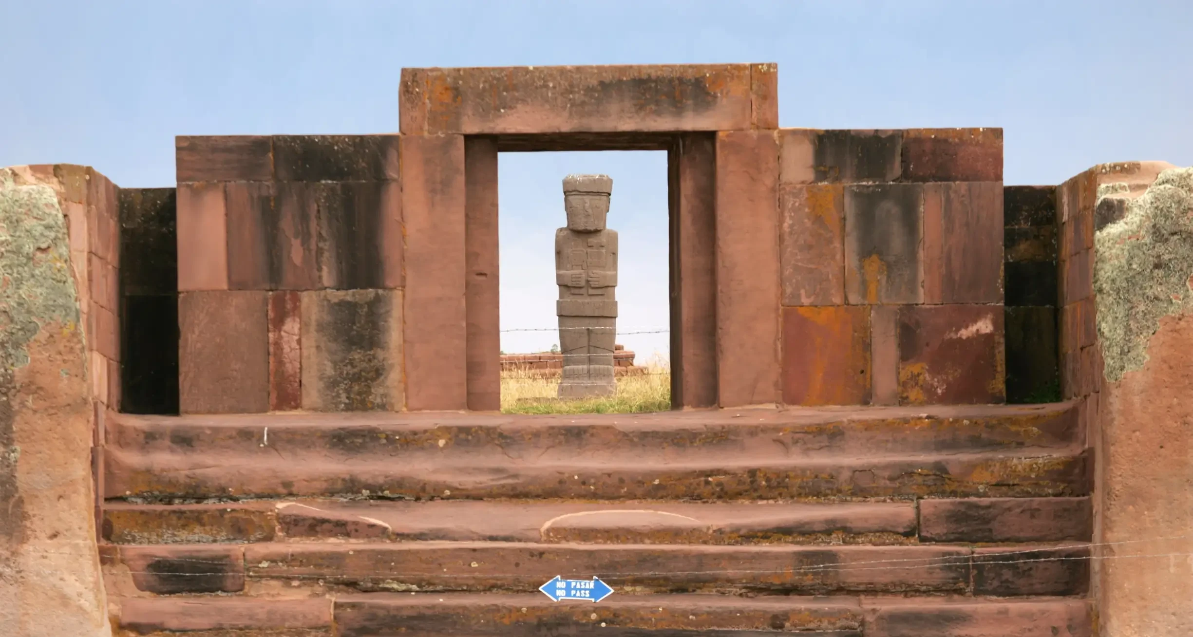
Tiwanaku
CULTURAL HISTORY
This magnificent cultural, political, and religious center is the splendid footprint of one of the most representative cultures in South America, whose influence extended to the subtropical valleys of our country, the Peruvian highlands, the Atacama Desert, and northern Argentina.
Undoubtedly, it is the most important archaeological legacy in our territory, due to the refinement of its architecture and its lithic sculptures, expressed in unique monuments like the Gate of the Sun, the Semi-subterranean Temple, the Akapana Pyramid, or the stunning Kalasasaya.
This archaeological complex reflects a moving search for perfection in the mastery of sciences and arts, which until today exerts a persistent influence on the religious thought, culture, aesthetics, and worldview of our Andean communities.
With more questions than answers, the origin and expansion of Tiwanaku is a fascinating mystery that continues to captivate researchers and visitors from around the world.
Location: Department of La Paz, Ingavi Province
Nearest capital city: La Paz, 72 km
Altitude: 3,842 m asl
Temperature: 10 °C, annual average
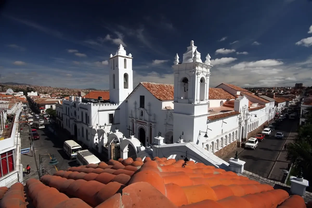
Sucre
THE WHITE CITY
Sucre is one of the most beautiful colonial cities in America. Seat of the Audiencia of Charcas in colonial times, cradle of the first libertarian movements, and capital of Bolivia since its independence, it preserves a magnificent colonial and neoclassical republican heritage, which reflects its importance as a political, social, artistic, academic, and cultural center. Sucre is a UNESCO World Cultural Heritage site.
The surroundings of Sucre also have natural, paleontological, and cultural attractions of great interest to the visitor.
Community Tourist Centers of Maragua and Potolo
The Jalq'a communities of the Chuquisaca Department are very well known for their beautiful textiles made with natural dyes and ancestral techniques. This project aims to value and preserve natural and cultural resources of the region through the construction of a Community Museum of Jalq'a Agricultural Culture. Five lodges, an artisan center, and a Traditional Medicine Museum complement the offer.
Cretaceous Park
Located in the Cal Orko area, a few minutes from the city of Sucre, it houses an important paleontological heritage, as there are found the most extensive dinosaur footprints found in the world. It is a thematic park, with extensive natural areas where life-size replicas of the dinosaur species corresponding to the found footprints have been placed. It has a thematic museum, restaurant services, and souvenir sales.
Location: Department of Chuquisaca, Oropeza Province
Altitude: 1,870 m asl
Temperature: 15 °C, annual average
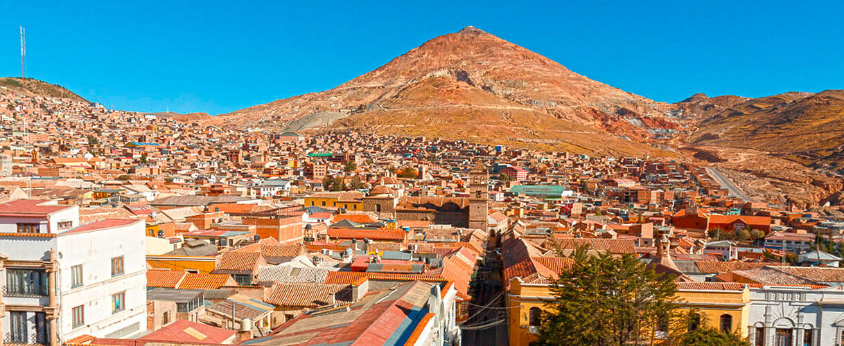
Potosí
WORLD HERITAGE
The history of Potosí is related to the mythical Cerro Rico and its extraordinary mineral riches. In the mid-seventeenth century, the Imperial Villa was synonymous with maximum wealth and splendor, transforming into one of the most important cities in the world. Along with La Paz, it is the cradle of the so-called Mestizo Baroque, a powerful artistic and architectural expression resulting from the cultural syncretism between the religious ideas of the Spanish conqueror and the spirituality of our indigenous peoples. Potosí is a UNESCO World Cultural Heritage site.
Café Planta Diesel Miraflores Museum, Uncía
Located in the vicinity of the famous "La Salvadora" mine, which belonged to the "Tin Baron" Simón Patiño. It is the restoration and repurposing of the old electricity generating plant, which houses 2 units similar to those of the Titanic, built by the same factory five years before the sinking of the famous ship. It presents a cozy café-museum, where the visitor can learn the history of Bolivian mining.
Diego Huallpa Mining Museum, Cerro Rico
With unprecedented and singular characteristics, this museum is located in tunnels of the mythical Cerro Rico, in the city of Potosí. It offers a tour through various thematic rooms, worked inside the mine, which allow the visitor to learn the history of silver and tin mining, belonging to the largest silver deposit, exploited during the colony.
Location: Department of Potosí, Tomás Frías Province
Altitude: 4,070 m asl
Temperature: 8.9 °C, annual average
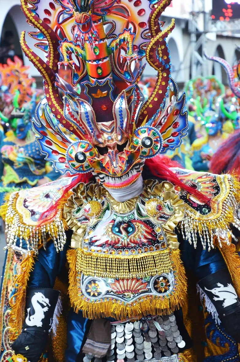
Oruro Carnival
MASTERPIECE OF CULTURE AND FOLKLORE
An extraordinary expression of the religious and cultural syncretism of Bolivia, the Oruro Carnival is the biggest folklore event in our country. The climax of this great celebration takes place on Carnival Saturday, when thousands of dancers grouped in fraternities perform the famous "Entrada," a three-kilometer route through the city streets, until reaching the Sanctuary of the Virgin of the Tunnel.
Spectacular dances like the Diablada, the Morenada, the Caporales, or the Tinku, of extraordinary plasticity and color, portray ancestral myths, traditions, and stories of the Andean peoples.
The Oruro Carnival is also a superb display of the mastery of local embroiderers and mask makers, who work most of the year to design and sew the costumes of the participants.
The Oruro Carnival has been declared a Masterpiece of the Oral and Intangible Heritage of Humanity by UNESCO. The Oruro department also has important cultural, archaeological, and natural attractions, such as Sajama National Park, one of the most visited in Bolivia.
Sacred Art Museum
Artisans, mask makers, embroiderers, and local artists carried out restoration work on the museum's environments and religious paintings of great heritage value.
Location: Department of Oruro, Cercado Province
Altitude: 3,706 m asl
Temperature: 10.7 °C, annual average
Check our Bolivia travel preparation guide
Click on the following button

Tripadvisor
