
Andes Mountain Range and Inca Trails
Mountain and Trekking in Bolivia
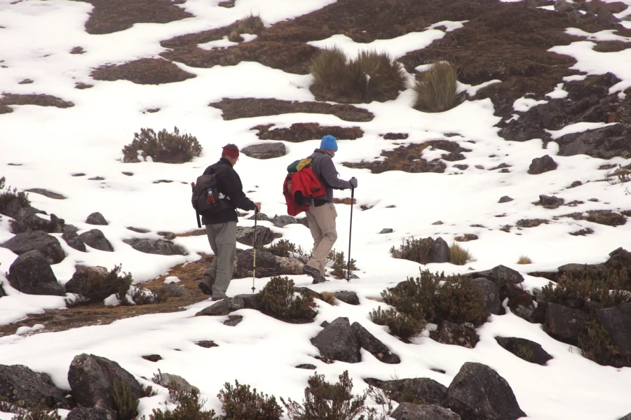
Bolivia is an ideal country for mountain activities and trekking; the Andes Mountain Range and its branches that cross the country offer adventurers, both experienced and novice, the possibility to continually challenge their skills. The most visited mountains are:
- Illimani, Mururata, Condoriri, Huayna Potosí, in the Real or Oriental Cordillera
- Sajama, Pomarape, and Parinacota, in the Occidental Cordillera
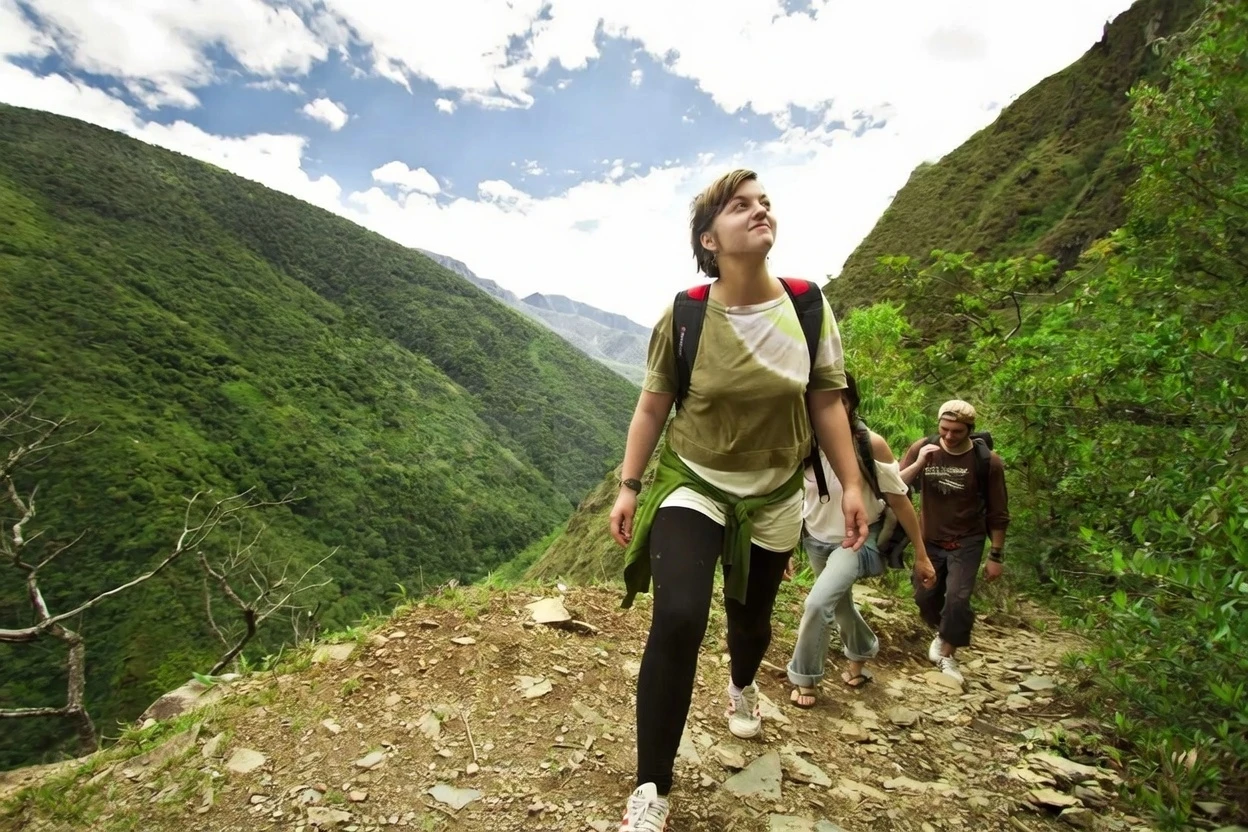
Regarding trekking, Bolivia is part of the great network of "Inca Roads" or Qhapaq ñam; one of its greatest values is the pre-Columbian path of Chucura or Choro that crosses Cotapata National Park in the Yungas of La Paz.
The most visited mountain for short hikes and panoramic views of the cordillera is "Chacaltaya," an extinct ski slope located 50 minutes from the city of La Paz; but if you seek more challenges, we recommend visiting "Huayna Potosí," the most accessible snow-capped peak, whose summit is at 6,088 m.a.s.l.
Discover the Places
Real or Oriental Cordillera
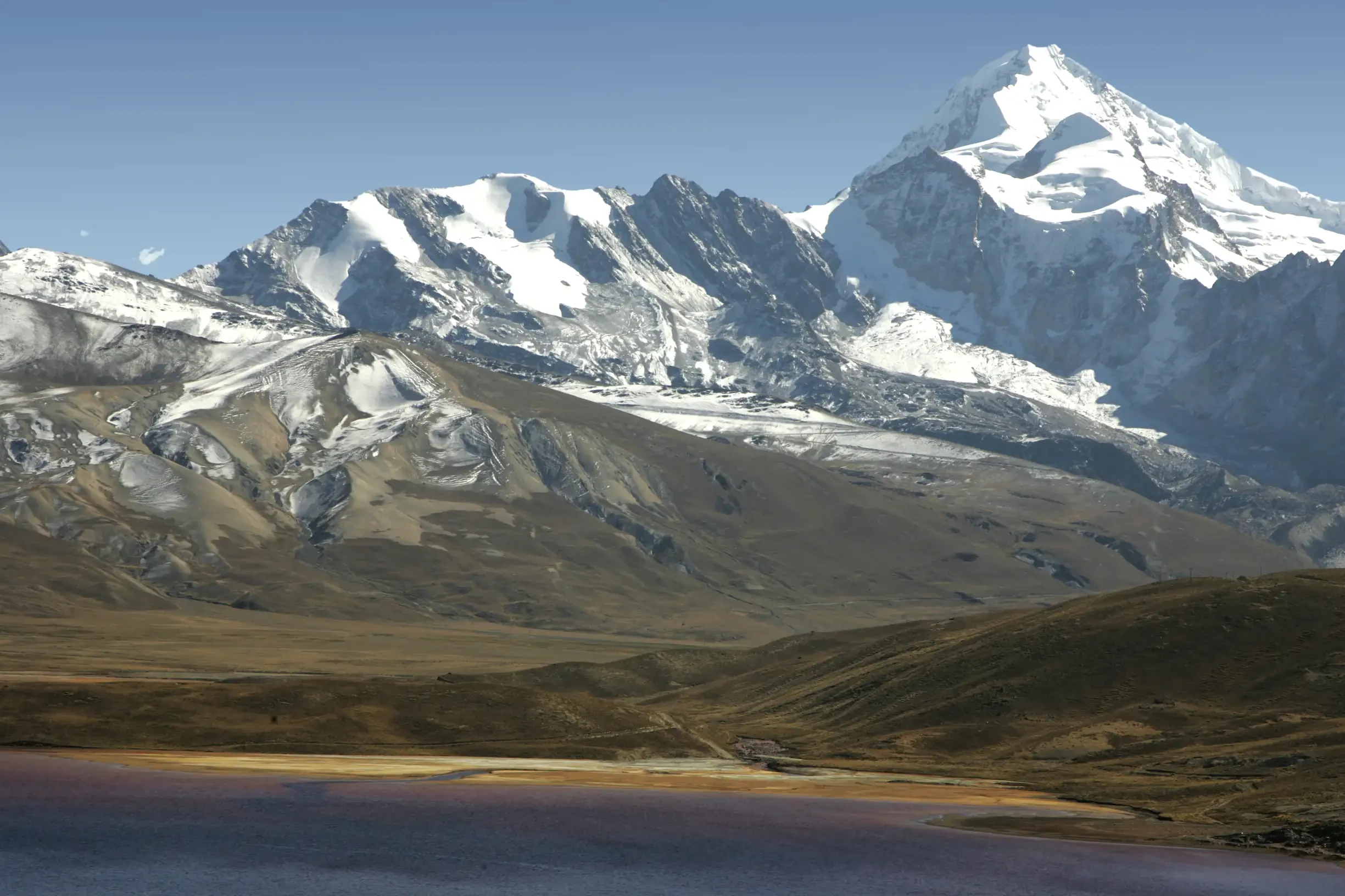
The Real or Oriental Cordillera spans a length of 200 kilometers, from the Illampu massif to Illimani. It runs in a northeast to southeast direction. It is divided into groups delimited by valleys and passes that appear from west to east. This branch of the Andean cordillera is the most important within Bolivian territory; it possesses high snowy peaks that rise above 6,000 m a.s.l., and among its large ravines, enormous glaciers can be observed.
The Real Cordillera presents countless alternatives for adventure sports, especially hiking on pre-Hispanic paths, mountaineering, sport fishing, among other tourist interests. The mountains that stand out include Ancohuma (6,427 m a.s.l.); Huayna Potosí (6,088 m a.s.l.) and Illimani (6,439 m a.s.l.) are just some of the most popular destinations for mountaineering.
- Nearest capital city: La Paz (located about 30 km west of the cordillera).
- Altitude: varies between ≈ 1,480 m in the Yungas valleys and ≈ 6,560 m in the glacial peaks (Illimani ≈ 6,439 m, Huayna Potosí ≈ 6,088 m).
- Average annual temperature: around 12 °C (average of the upper area of La Paz, whose average annual temperature ranges between 10 °C and 14 °C).
Occidental Cordillera
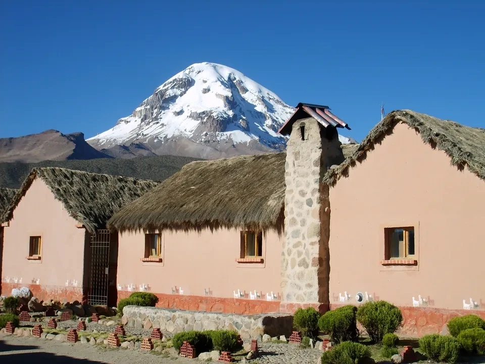
The Occidental Cordillera of Bolivia constitutes the mountain strip that borders the western border of the country with Chile and extends in an approximately north-south direction, starting at the Juqhuri knot and culminating at the Licancabur volcano at the southern extreme. Its length exceeds 600 km and is dominated by a chain of young volcanoes, among which stand out Nevado Sajama (6,542 m ≈ 21,463 ft), the highest summit of Bolivia, and Acotango (6,052 m), as well as Licancabur itself (≈ 5,920 m).
This cordillera offers innumerable possibilities for adventure tourism: climbing and mountaineering on glacial peaks, high-mountain trekking through stone desert landscapes and altiplano lagoons, excursions to the craters and fumaroles of active volcanoes, and observation of flora and fauna adapted to extreme conditions. Its abrupt slopes, deep valleys, and proximity to the Salar de Uyuni make the Occidental Cordillera one of the most spectacular and challenging scenarios of the Bolivian Andes.
- Nearest capital city: La Paz (for the northwestern sector) and Oruro (for the southwestern sector); both cities are less than 200 km from the cordillera.
- Altitude: the reliefs range between ≈ 4,000 m and ≈ 6,500 m a.s.l., with the highest peak being Nevado Sajama (6,542 m).
- Average annual temperature: approximately 12 °C (value comparable to the climate of the altiplano plateau, where the average annual temperature ranges around 11‑13 °C).
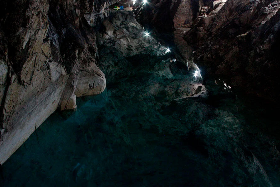
San Pedro Cave
Located in the municipality of Sorata in the La Paz department, the famous San Pedro Cave has been equipped with new tourist infrastructure that allows appreciation of the beautiful cavern, in addition to access to the lagoon and boat rides. The immediate surroundings offer cabins for accommodation, natural water pool, speleological center, walks, viewpoints, outdoor recreation areas with grills and playground.
- Location: La Paz Department, Provinces of Omasuyos, Larecaja, Los Andes and Murillo
- Nearest capital city: La Paz
- Altitude: between 6,560 and 1,480 m.a.s.l.
- Temperature: 12°C average annual
Hikes
Chacaltaya, 1 Day
Good opportunity to acclimatize and prepare for new ascents of 5,300 m a.s.l.
- 1 day of hiking
Tuni Condoriri
In Tuni Condoriri National Park, through high-Andean lagoons and beautiful landscapes at the foot of the snow-capped peak of 5,648 m a.s.l.
- 1 day of hiking
Takesi
Crossing the mountains of the Real Cordillera to the subtropical zone of the Yungas, through pre-Columbian routes also called the "Inca Trail."
- 2 days of hiking
- 1 night of camping at 3,700 m a.s.l.
El Choro
Crossing the mountainous zone of La Cumbre to begin descending toward the Yungueña zone of Coroico, from an altitude of 4,600 m a.s.l. to 1,300 m a.s.l.
- 3 days of hiking
- 2 nights of camping
Huayna Potosí
It is the most visited snow-capped peak among those with an altitude greater than 6,000 m, recommended for people acclimatized to altitude.
Starting from the base camp near the ghost town of Milluni, on the 1st day we ascend to 5,000 m a.s.l. and on the second day very early we head toward the summit at 6,088 m a.s.l.
- 2 or 3 days of hiking
- 1 or 2 days of camping
Sajama
Visit to Sajama National Park, where the Sajama volcano is located, the highest in Bolivia at 6,542 m a.s.l. Hiking through queñua forests, geysers, Khasiri and Sorapata Lagoons. Also the polychrome chullpas of Río Lauca.
- 3 days of hiking
- 2 days of camping
Includes
Not Included
Tripadvisor

Request a quote
Trekking and Climbing
From 1 to 21 days